Predictive, Proactive, Pre-emptive Response Planning
Intelligent Solutions for a Safer World
GIS-driven systems for risk mapping, early warning, and real-time coordination – enabling faster response and improved disaster resilience across floods, fires, droughts, and earthquakes.

Our Solutions
Intelligent Disaster Management Solutions
Our GIS-driven disaster management solutions enable proactive risk mitigation, vulnerability analysis, hazard mapping, and decision support for flood, fire, drought, and earthquake management systems.

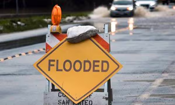
Flood Management System
- Data Gathering
- Flood inundation models
- Response Maps
- Early Warning System
- Calculation & Planning for efficient evacuation routes
Fire Management System
- Data Gathering
- Demarcate evacuation zones
- Early Warning System
- Hotspot detection
- Calculation of shortest path
- Web-GIS based Geo-Platform to assess fire locations in temporal manner
Drought Management System
- Monitoring of Drought & Early Warning
- Remote sensing based Vegetative Indices
- Integrated Meteorological Data Dashboard
- Drought Vulnerability & Risk Maps
- GIS enabled planning, implementation, monitoring and evaluation
Earthquake / Bldg. Collapse Mgmt. System
- Inventory of details for relief & rescue
- Creation of seismic micro zonation maps
- Creation of vulnerability maps
- Hospital Mapping
- Capture and integrate 3D building design and models with floor level plans
- Specialize in real-time dashboards for Disaster Management. Collaborated with world-class OEMs and curated our customised solutions for the same
Dashboard Management System
- Unified master dataset with georeferencing
- Dashboards and applications (web & mobile) for reporting, warnings, alerts and advisories
- Command & Control Centre for trends & forecasts
- Helpdesk Access Integration of various state and local bodies for effective governance
Case Studies
Explore in-depth success stories, strategic solutions, and real-world impact through our featured projects.